Google’s New AI Just Unlocked the Future of Real Estate — And It’s Free to Use!
Imagine being able to forecast the next real estate boom?

A powerful AI tool now lets you map urban growth in real time. Could this be your unfair advantage in real estate?
Imagine being able to foresee the next hot neighbourhood before construction ever begins. Imagine being able to identify the most desirable real estate areas, track urbanisation, and analyse trends in city expansion with just a few clicks.
That was just made possible by Google.
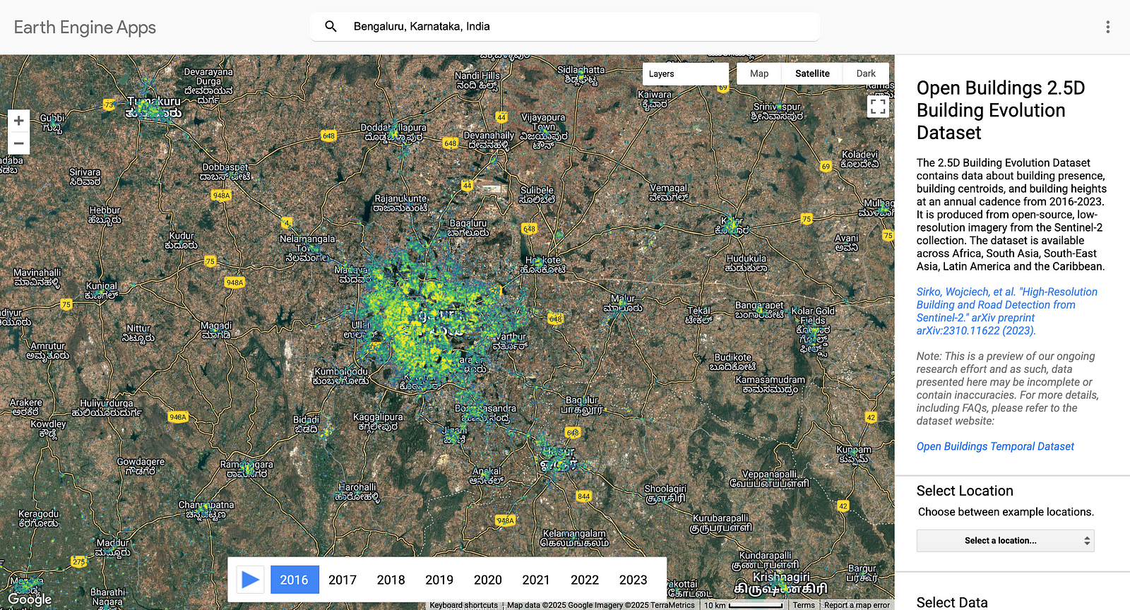
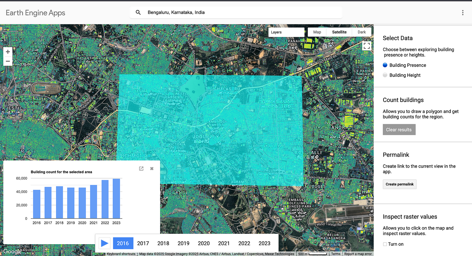
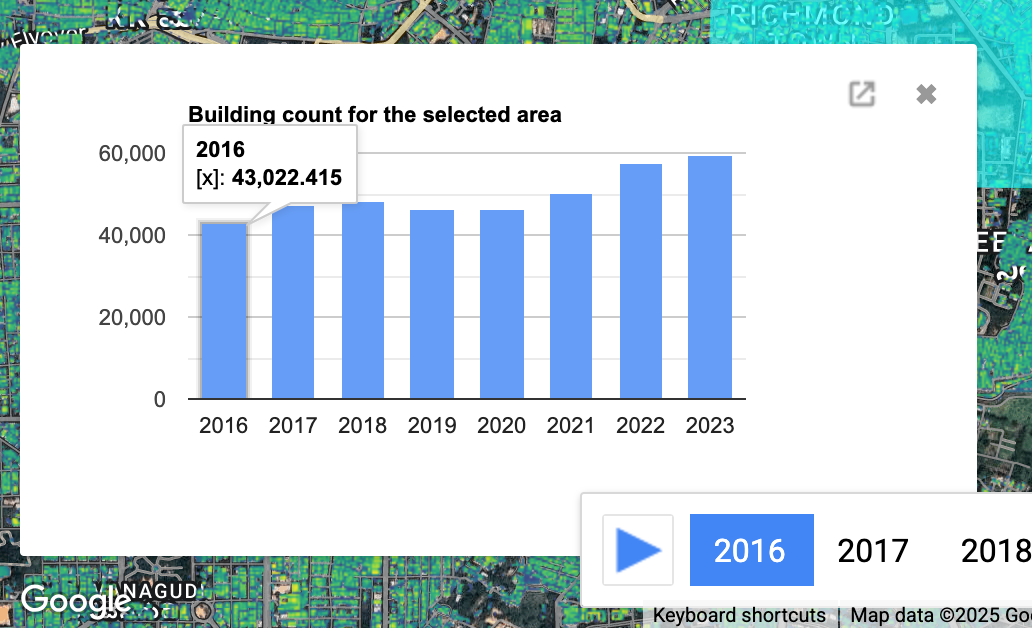
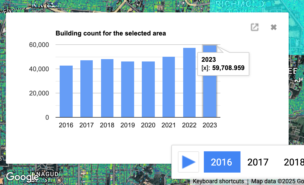
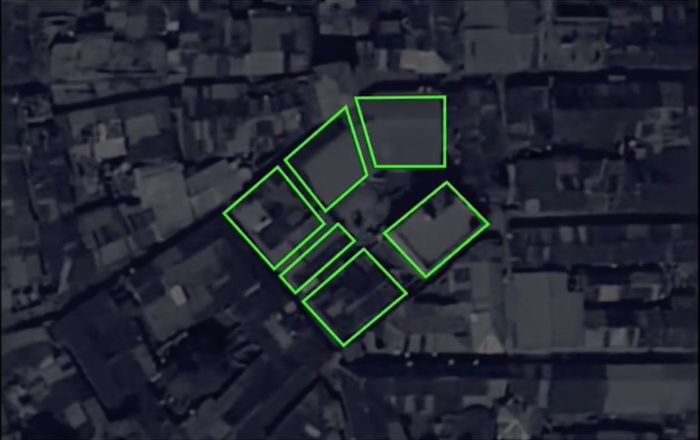
Anyone can choose any location on a map and instantly see not only the number of buildings but also an estimate of their heights over time with their new AI-powered tool, Open Buildings 2.5D. This enables you to see how a region is changing, whether it is expanding, stagnating, or rapidly becoming a real estate hotspot.
What’s the best part? You can use it for free.
by https://sites.research.google/gr/open-buildings/temporal/
How It Works: AI-Powered Urban Growth Tracking
Sentinel-2 satellite imagery is used by Google’s AI to scan and analyze 32 million square kilometers of land in Asia, Latin America, and Africa. The tool can estimate building heights and monitor changes over time using machine learning models trained on historical satellite data.
Why is that important? Building height is a direct indicator of economic growth, investment potential, and urban expansion, so it’s not just about aesthetics.
A rapid rise in the number of taller buildings in an area is frequently a sign of rising demand, rising property values, and the possibility of substantial future growth.
Take Bangalore, India, for example. The skyline of South Bangalore, a well-known commercial hub for a long time, is dominated by high-rises (Whitefield, Bellandur). However, as seen by the dramatic rise in building height and quantity, North Bangalore is quickly catching up.This construction is not only careless, but it also portends significant expenditures, upgrades to the infrastructure, and a future real estate boom.
You can stop depending on conventional market speculation by utilizing this AI tool. Instead, you receive up-to-date, fact-based information on trends in urban development before they become widely recognized.
by https://sites.research.google/gr/open-buildings/temporal/
From 2016 to 2023
by https://sites.research.google/gr/open-buildings/temporal/
The Real-World Impact: Who Can Benefit?
Google’s AI-powered mapping tool is not limited to real estate visualization; it can be applied to a wide range of industries. Think of it this way: city officials and urban planners can use the tool to identify underdeveloped neighborhoods that need better infrastructure.
Environmental scientists, however, can keep an eye on how growing cities affect neighboring parks and ecosystems. Long before it becomes the next hot market, real estate developers may notice a hint of change, such as a quiet neighborhood beginning to see a shift from low-rise homes to taller buildings.
Beyond that, researchers and journalists can look at housing trends, population shifts, and economic shifts to fully understand how our communities are changing. It all boils down to using data to stay ahead of the curve in any field.
by https://sites.research.google/gr/open-buildings/temporal/
Will This Tool Change How We Predict the Future of Cities?
Tools like Open Buildings 2.5D allow people to access insights that were previously only accessible by large institutions with costly data models in an era where artificial intelligence is revolutionizing decision-making.
You can now see the data for yourself — before anyone else does — instead of waiting for news articles or real estate brokers to tell you where the next big opportunity is.
The mystery of urban expansion has been solved. It was recently transformed into a real-time explorable map by Google’s AI.

Photo by Tom Rumble on Unsplash
The Bigger Picture: A Glimpse into the Future
While artificial intelligence is only just beginning to be made, it’s already starting to make the world a very different place in how we see and comprehend cities. Just consider the possibilities of being able to predict how cities are going to expand in the future based on a vast amount of information pertaining to roads, buildings, and finance. This information could allow investors with the means to know the most profitable places where to invest early in property, as well as allow government officials to create and implement better urban planning techniques.
What’s so amazing about this breakthrough? It’s that this amazing tool made available by Google is free to anyone, not just to massive corporations with a lot of money. Whether you’re a city planner trying to make good decisions, an investor trying to make money, or just someone who’s extremely interested in the expansion of cities, this is an amazing chance to see what could be in the future before it gets here!
So, are you ready to spot the next big thing before it happens?
The Open Buildings 2.5D dataset from Google offers elevation data along with temporal building footprints, which is helpful for market trends, urban analysis, and estate prediction. You should check out Google Open Buildings 2.5D.
Join Kalash on Peerlist!
Join amazing folks like Kalash and thousands of other people in tech.
Create ProfileJoin with Kalash’s personal invite link.
0
4
0